An epidemiological survey to determine the distribution of OsHV-1 in oysters on all active oyster leases and in water was conducted on January 29. Its purpose was twofold: firstly to see whether the disease had been spread by movements of oysters from Mullet Creek (it had, see above) and secondly to determine whether any areas remained free of infection.
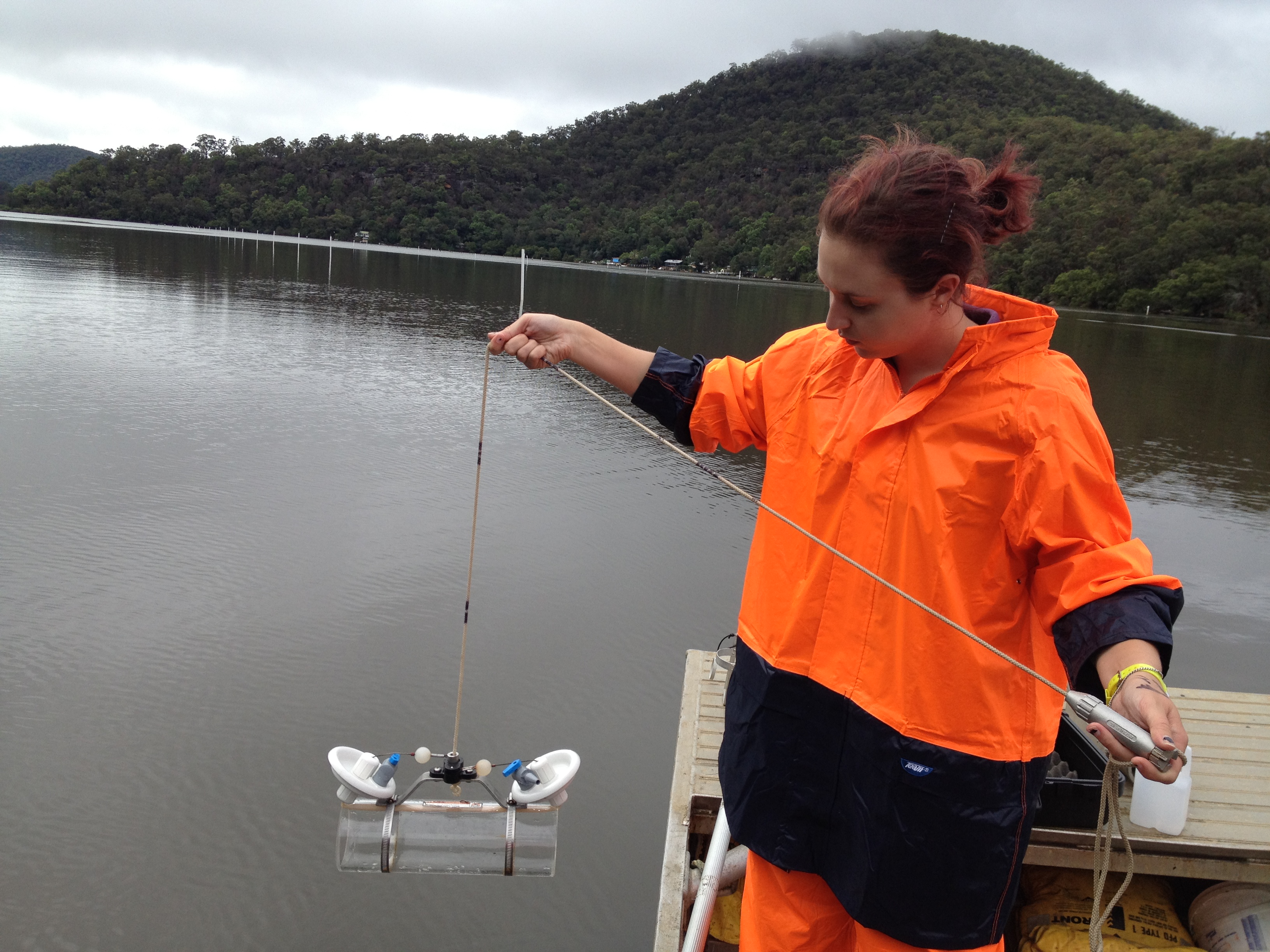
University of Sydney PhD student Olivia Evans collects a water sample on January 29..
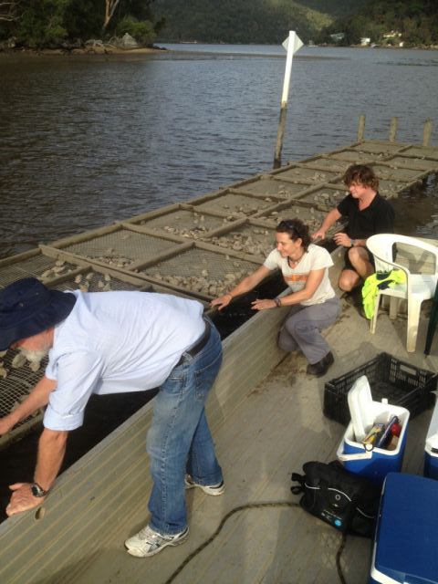
Steve McOrrie (left, NSW DPI), Ana Rubio (centre, Hornsby Shire Council) and Rob Moxham (right, Broken Bay Oysters) randomly select oysters for the survey.
This information was vital to oyster growers because they had voluntarily stopped all oyster movements, assumed that infection was present only in Mullet creek, implemented costly disinfection protocols for boats and equipment and they were severely constrained in management of their farms for fear of spreading infection to healthy stock.
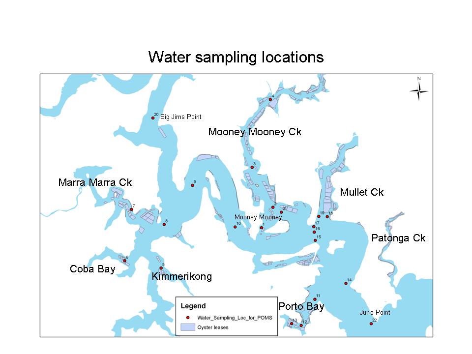
The survey yielded important and comprehensive results within 72 hours. It revealed that OsHV-1 was present throughout the lower Hawkesbury River system in water, presumably due to tidal flow. This was modelled and ranged from 6 to 16 km upstream of Mullet Creek with each tidal cycle. The location of water samples is shown on the map below and reveals the extent of viral contamination. The virus was also present in a variable proportion of oysters on all leases in all major bays, but the level of virus in oyster tissues was very low.
Based on prior data from our studies in the Georges River we predicted that mortality could occur in oysters across the river at any time and maintained a recommendation for emergency harvest when the river was opened by the NSW Food Authority (it was closed due to heavy rainfall). Knowledge that infection was already widespread enabled BBOA growers to assess risk, discuss movement of oysters again, and remove time consuming disinfection protocols.
The survey design protocol is available as a download, please click on the following link: Survey design POMS Hawkesbury River 25-1-13
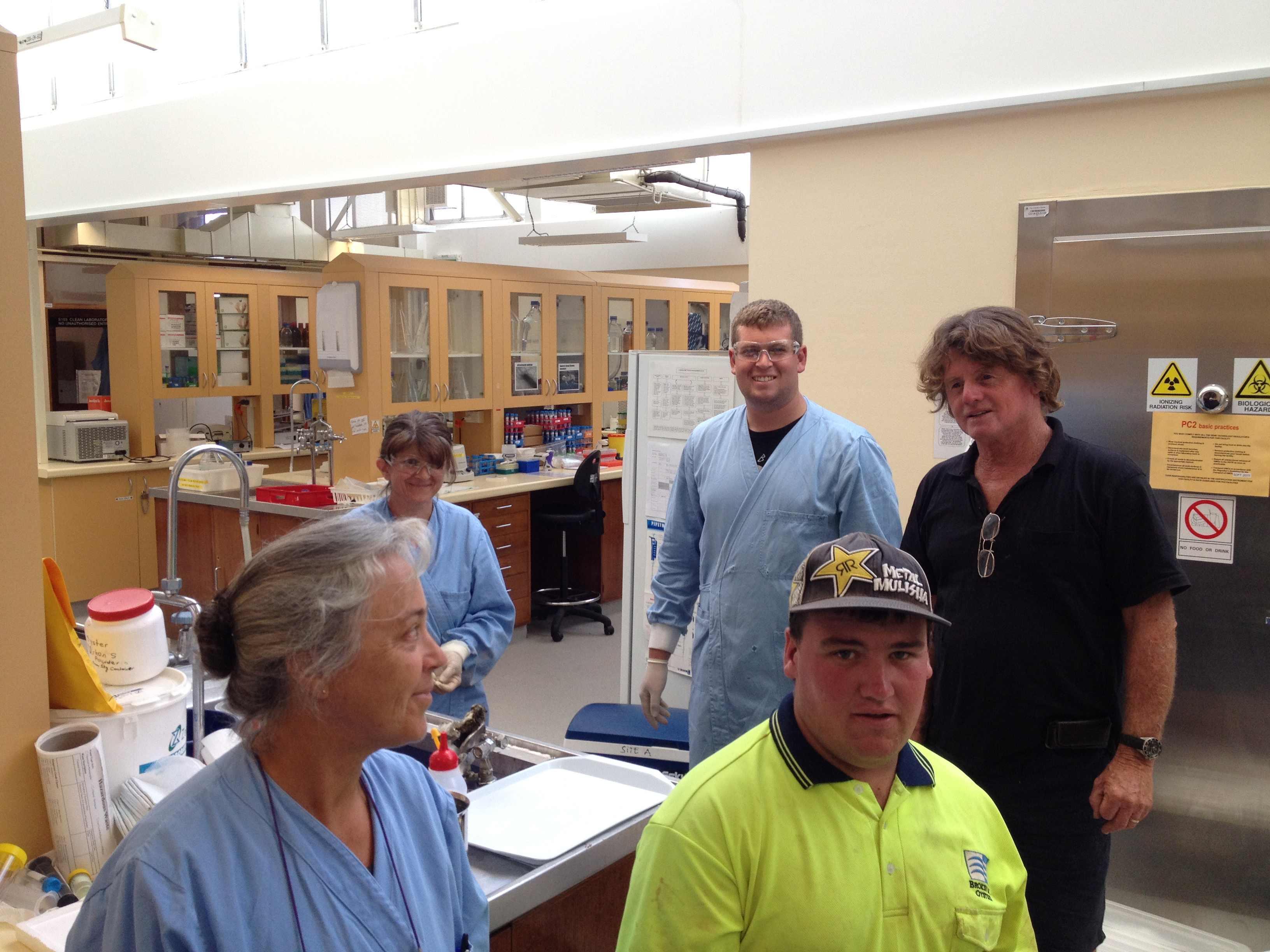
Oyster grower Rob Moxham and his right hand man Mitch at the University of Sydney laboratory to deliver oysters for PCR tests and meet staff